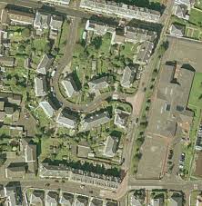
Surveying plays a crucial role in various industries, from construction and infrastructure development to urban planning and environmental conservation. Traditionally, surveying involved ground-based measurements and manual data collection methods, which were time-consuming and often limited in scope. However, with the advancements in technology, specifically aerial imagery services, surveying in the UK has been revolutionized. Utilizing drones and other airborne platforms equipped with high-resolution cameras and LiDAR sensors, aerial imagery services offer numerous benefits for surveying projects. Let's explore some of these advantages:
Enhanced Efficiency: Aerial imagery services enable surveyors to cover large areas in a significantly shorter time compared to traditional ground-based methods. Drones equipped with high-resolution cameras can capture detailed imagery and collect vast amounts of data rapidly. This efficiency leads to faster project completion, reduced fieldwork time, and accelerated decision-making processes.
Improved Accuracy: Aerial imagery services provide surveyors with highly accurate data, resulting in precise measurements and mapping. The high-resolution imagery captured from above offers a comprehensive and detailed view of the surveyed area. Combined with advanced processing techniques, such as photogrammetry and LiDAR technology, aerial imagery services produce accurate topographic maps, 3D models, and digital elevation data, ensuring precise surveying results.
Expanded Coverage: Aerial surveying eliminates the limitations imposed by physical barriers and inaccessible terrain. Drones can navigate difficult-to-reach areas, including rugged landscapes, dense forests, and hazardous environments, with ease. This capability enables surveyors in the UK to conduct comprehensive surveys and collect data from locations that would otherwise be challenging or time-consuming to access.
Cost-Effectiveness: Aerial imagery services offer cost savings in several ways. First, the speed and efficiency of aerial surveys reduce labor costs and minimize the need for extensive ground-based surveying teams. Second, the data collected by aerial platforms can be processed digitally, eliminating the need for manual data entry and reducing potential errors. Lastly, the detailed and accurate information obtained through aerial surveys enables better project planning and reduces the risk of costly design errors or rework.
Safety and Risk Mitigation: Aerial surveys contribute to improved safety during surveying operations. By utilizing drones, surveyors can eliminate or significantly reduce the need for personnel to work in hazardous or potentially dangerous environments. This minimizes risks associated with working at heights, on unstable ground, or in areas with potential safety hazards.
Environmental Considerations: Aerial imagery services promote environmentally friendly surveying practices. The use of drones produces a minimal ecological footprint compared to traditional surveying methods, which may involve heavy machinery or ground disturbance. Aerial surveys also minimize disruption to natural habitats and sensitive ecosystems, making them an ideal choice for environmental impact assessments and conservation efforts in the UK.
Enhanced Data Visualization and Analysis: Aerial imagery services provide surveyors with a wealth of data that can be visualized and analyzed in various ways. Advanced software tools allow for the creation of detailed 3D models, contour maps, and virtual flythroughs. This data visualization and analysis capability enables better understanding and interpretation of the surveyed area, supporting informed decision-making for design, planning, and development projects.
In conclusion, aerial imagery services have transformed the field of surveying in the UK. From improved efficiency and accuracy to expanded coverage and cost savings, the benefits of utilizing drones and aerial platforms for surveying are undeniable. By embracing aerial imagery services, surveyors in the UK can unlock new possibilities, streamline their operations, and achieve better outcomes in their projects.


0 comments:
Post a Comment